
این کتاب به صورت رنگی است.
Product details
- Publisher : Pearson; 4th edition (April 21, 2015)
- Language : English
- Hardcover : 656 pages
- ISBN-10 : 013405816X
- ISBN-13 : 978-0134058160
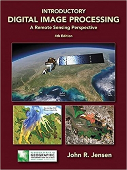
کتاب Introductory Digital Image Processing: A Remote Sensing Perspective (Pearson Series in Geographic Information Science)
For junior/graduate-level courses in Remote Sensing in Geography, Geology, Forestry, and Biology.
Introductory Digital Image Processing: A Remote Sensing Perspective focuses on digital image processing of aircraft- and satellite-derived, remotely sensed data for Earth resource management applications. Extensively illustrated, it explains how to extract biophysical information from remote sensor data for almost all multidisciplinary land-based environmental projects. Part of the Pearson Series Geographic Information Science.
Now in full color, the Fourth Edition provides up-to-date information on analytical methods used to analyze digital remote sensing data. Each chapter contains a substantive reference list that can be used by students and scientists as a starting place for their digital image processing project or research. A new appendix provides sources of imagery and other geospatial information.
منابع کتاب کتاب Introductory Digital Image Processing: A Remote Sensing Perspective (Pearson Series in Geographic Information Science)
برای دوره های سطح پایین/فارغ التحصیل در سنجش از دور در جغرافیا، زمین شناسی، جنگلداری و زیست شناسی.
پردازش تصویر دیجیتال مقدماتی: دیدگاه سنجش از دور بر پردازش تصویر دیجیتالی دادههای سنجش از دور مشتق شده از هواپیما و ماهواره برای برنامههای مدیریت منابع زمین تمرکز دارد. به طور گسترده نشان داده شده است، نحوه استخراج اطلاعات بیوفیزیکی از داده های حسگر از راه دور برای تقریباً تمام پروژه های زیست محیطی چند رشته ای مبتنی بر زمین را توضیح می دهد. بخشی از سری پیرسون علم اطلاعات جغرافیایی.
اکنون به صورت تمام رنگی، نسخه چهارم اطلاعات به روزی را در مورد روش های تحلیلی مورد استفاده برای تجزیه و تحلیل داده های سنجش از راه دور دیجیتال ارائه می دهد. هر فصل حاوی یک فهرست مرجع اساسی است که می تواند توسط دانش آموزان و دانشمندان به عنوان نقطه شروع برای پروژه یا تحقیق پردازش تصویر دیجیتال خود استفاده شود. یک ضمیمه جدید منابعی از تصاویر و سایر اطلاعات مکانی را ارائه می دهد.

")


")

: Autodesk Authorized Publisher")
")
")

")


 1st Edition")


ارسال نظر درباره کتاب Introductory Digital Image Processing: A Remote Sensing Perspective (Pearson Series in Geographic Information Science)