Product details
- ASIN : 1617291390
- Publisher : Manning; 2nd edition (May 3, 2015)
- Language : English
- Paperback : 600 pages
- ISBN-10 : 9781617291395
- ISBN-13 : 978-1617291395
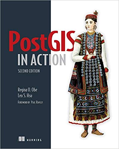
جلد سخت رنگی_کتاب PostGIS in Action, 2nd Edition
Summary
PostGIS in Action, Second Edition teaches readers of all levels to write spatial queries that solve real-world problems. It first gives you a background in vector-, raster-, and topology-based GIS and then quickly moves into analyzing, viewing, and mapping data. This second edition covers PostGIS 2.0 and 2.1 series, PostgreSQL 9.1, 9.2, and 9.3 features, and shows you how to integrate with other GIS tools.
Purchase of the print book includes a free eBook in PDF, Kindle, and ePub formats from Manning Publications.
About the Book
Processing data tied to location and topology requires specialized know-how. PostGIS is a free spatial database extender for PostgreSQL, every bit as good as proprietary software. With it, you can easily create location-aware queries in just a few lines of SQL code and build the back end for a mapping, raster analysis, or routing application with minimal effort.
PostGIS in Action, Second Edition teaches you to solve real-world geodata problems. It first gives you a background in vector-, raster-, and topology-based GIS and then quickly moves into analyzing, viewing, and mapping data. You'll learn how to optimize queries for maximum speed, simplify geometries for greater efficiency, and create custom functions for your own applications. You'll also learn how to apply your existing GIS knowledge to PostGIS and integrate with other GIS tools.
Familiarity with relational database and GIS concepts is helpful but not required.
What's Inside
- An introduction to spatial databases
- Geometry, geography, raster, and topology spatial types, functions, and queries
- Applying PostGIS to real-world problems
- Extending PostGIS to web and desktop applications
- Updated for PostGIS 2.x and PostgreSQL 9.x
About the Authors
Regina Obe and Leo Hsu are database consultants and authors. Regina is a member of the PostGIS core development team and the Project Steering Committee.
Table of Contents
PART 1 INTRODUCTION TO POSTGIS
PART 2 PUTTING POSTGIS TO WORK
PART 3 USING POSTGIS WITH OTHER TOOLS
- What is a spatial database?
- Spatial data types
- Spatial reference system considerations
- Working with real data
- Using PostGIS on the desktop
- Geometry and geography functions
- Raster functions
- PostGIS TIGER geocoder
- Geometry relationships
- Proximity analysis
- Geometry and geography processing
- Raster processing
- Building and using topologies
- Organizing spatial data
- Query performance tuning
- Extending PostGIS with pgRouting and procedural languages
- Using PostGIS in web applications
منابع کتاب جلد سخت رنگی_کتاب PostGIS in Action, 2nd Edition
خلاصه
PostGIS in Action، نسخه دوم به خوانندگان همه سطوح می آموزد که پرس و جوهای فضایی بنویسند که مشکلات دنیای واقعی را حل می کند. ابتدا پیش زمینه ای در GIS مبتنی بر برداری، شطرنجی و توپولوژی به شما می دهد و سپس به سرعت به سمت تجزیه و تحلیل، مشاهده و نقشه برداری داده ها می رود. این نسخه دوم سری PostGIS 2.0 و 2.1، PostgreSQL 9.1، 9.2 و 9.3 را پوشش می دهد و به شما نشان می دهد که چگونه با سایر ابزارهای GIS یکپارچه شوید.
خرید کتاب چاپی شامل یک کتاب الکترونیکی رایگان در قالبهای PDF، Kindle و ePub از انتشارات منینگ است.
درباره کتاب
پردازش داده های مرتبط با مکان و توپولوژی نیاز به دانش تخصصی دارد. PostGIS یک توسعه دهنده پایگاه داده فضایی رایگان برای PostgreSQL است که به اندازه نرم افزار اختصاصی خوب است. با استفاده از آن، میتوانید بهراحتی پرسوجوهای آگاه از مکان را تنها در چند خط کد SQL ایجاد کنید و با کمترین تلاش، قسمت پشتی برنامههای نقشهبرداری، تحلیل شطرنجی یا مسیریابی را بسازید.
PostGIS در عمل، ویرایش دومبه شما می آموزد که مسائل مربوط به داده های جغرافیایی در دنیای واقعی را حل کنید. ابتدا پیش زمینه ای در GIS مبتنی بر برداری، شطرنجی و توپولوژی به شما می دهد و سپس به سرعت به سمت تجزیه و تحلیل، مشاهده و نقشه برداری داده ها می رود. شما یاد خواهید گرفت که چگونه پرس و جوها را برای حداکثر سرعت بهینه کنید، هندسه ها را برای کارایی بیشتر ساده کنید و توابع سفارشی را برای برنامه های خود ایجاد کنید. همچنین یاد خواهید گرفت که چگونه دانش GIS موجود خود را در PostGIS به کار ببرید و با سایر ابزارهای GIS ادغام کنید.
آشنایی با پایگاه داده رابطه ای و مفاهیم GIS مفید است اما الزامی نیست.
چه چیزی در داخل است
- مقدمه ای بر پایگاه داده های فضایی
- هندسه، جغرافیا، شطرنجی و توپولوژی انواع فضایی، توابع و پرس و جوها
- استفاده از PostGIS برای مشکلات دنیای واقعی
- گسترش PostGIS به برنامه های وب و دسکتاپ
- به روز شده برای PostGIS 2.x و PostgreSQL 9.x
درباره نویسندگان
رجینا اوبه و لئو هسو مشاوران و نویسندگان پایگاه داده هستند. رجینا یکی از اعضای تیم توسعه هسته PostGIS و کمیته راهبری پروژه است.
فهرست مطالب
بخش 1 مقدمه POSTGIS
قسمت 2 قرار دادن POSTGIS به کار
قسمت 3 استفاده از POSTGIS با ابزارهای دیگر
- پایگاه داده فضایی چیست؟
- انواع داده های مکانی
- ملاحظات سیستم مرجع فضایی
- کار با داده های واقعی
- استفاده از PostGIS روی دسکتاپ
- توابع هندسه و جغرافیا
- توابع شطرنجی
- ژئوکدر PostGIS TIGER
- روابط هندسه
- تحلیل مجاورت
- پردازش هندسه و جغرافیا
- پردازش شطرنجی
- ساخت و استفاده از توپولوژی ها
- سازماندهی داده های مکانی
- تنظیم عملکرد پرس و جو
- گسترش PostGIS با pgRouting و زبان های رویه ای
- استفاده از PostGIS در برنامه های کاربردی وب

















ارسال نظر درباره جلد سخت رنگی_کتاب PostGIS in Action, 2nd Edition